Land for sale Land At Walden, West Burton, Leyburn, North Yorkshire DL8
£575,000 guide price Letting fees
Picture No. 01
Picture No. 03
Picture No. 04
Picture No. 05
Picture No. 06
Picture No. 07

Picture No. 08
Picture No. 09
Picture No. 10
Picture No. 11
Key info
- Status: For sale
- Type: Land
- Area: Land At Walden, Leyburn, North Yorkshire
Price changes
| £575,000 | 19 days ago |
Full description
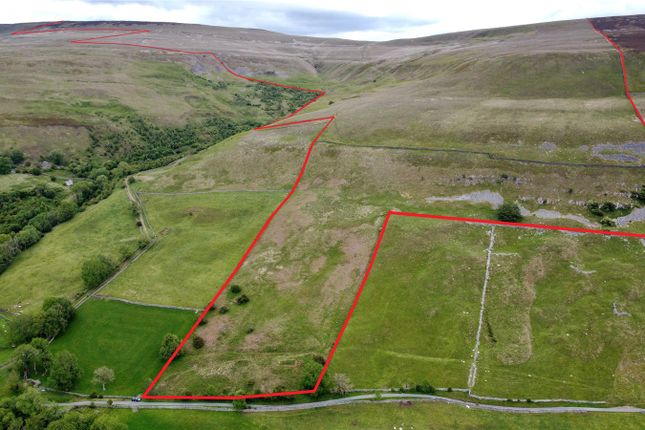
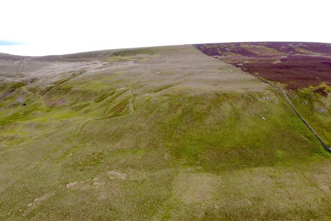
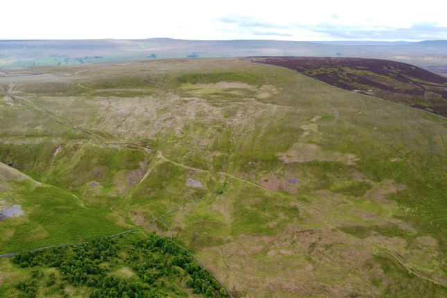
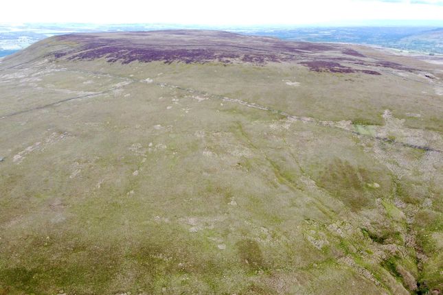
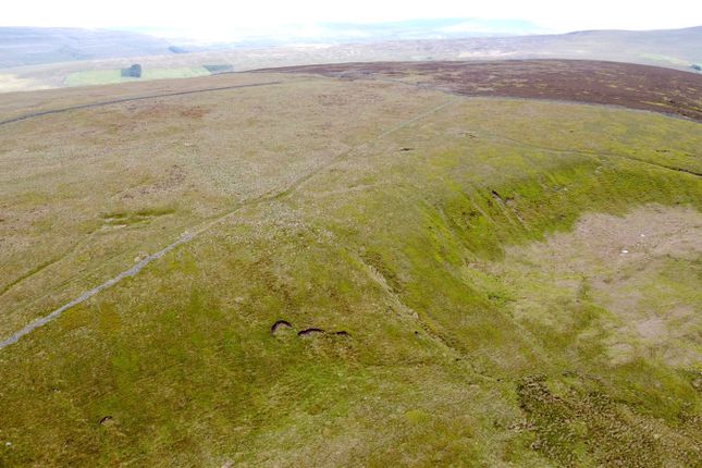
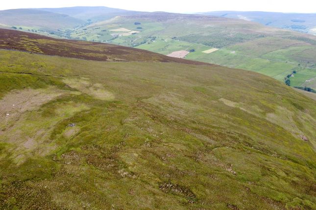
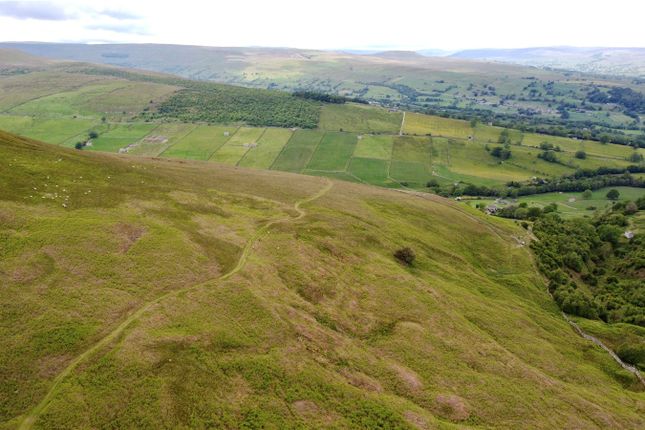
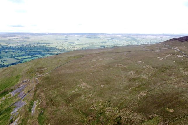
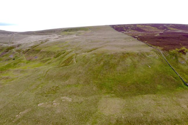
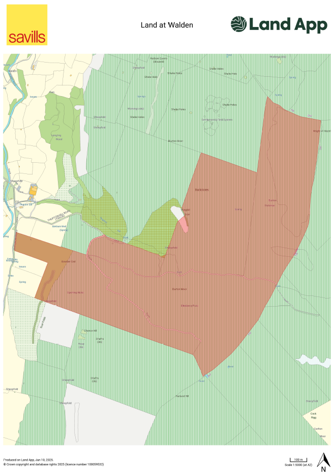
325.32 acres (133.1 ha) of moorland and allotment in the Yorkshire Dales National Park.DescriptionThe sale represents a superb opportunity to purchase a ring fenced block of 325.32 acres (133.1 ha) of moorland and allotment, in the scenic Walden Valley south of Wensleydale. The land spectacularly rises from the valley towards the peaks of Penhill, Height of Hazely and Harland Hill.Situated on the eastern flank of Walden Valley, the land sits between 210 and 530 metres above sea level and includes, grassland, bracken, ‘white ground’ allotment land, rocky outcrops, expansive open areas and heather moorland. Adjacent to the land lies significant heather moorland areas falling away to the Yorkshire Dales. The land surrounds and drains steeply into Thupton Gill, about 1 mile south of West Burton village, the watercourse leads to Walden Beck, Bishopdale Beck and ultimately into the River Ure.The land benefits from direct vehicular access from Whiterow Road (a public highway) and a steep unmade road, known as Thupton Gill Road. There are further internal tracks suitable for small 4x4’s or rough terrain vehicles.The land lies outside of any Sites of Special Scientific Interest (sssi), Special Area of Conservation (sac) or Special Protection Areas (spa).The sale offers significant natural capital, amenity, biodiversity, and environmental opportunities, with rare flexibility for such a parcel. Future management could take the form of biodiversity and habitat enhancement, such as heather restoration and where appropriate peatland restoration. In addition the land could offer opportunities for Natural Flood Management and Afforestation.The majority of the land sits above the moorland line and with a successful heather restoration programme could provide future sporting amenity and enjoyment for a purchaser.Acreage:325.32 AcresAdditional InfoRights of Way, Easements & Wayleaves - The property is sold subject to and with the benefit of all existing wayleaves, easements, and rights of way. A public bridleway crosses the land east to west from the public highway Whiterowe Road, the route runs in part along Thupton Gill Road, climbing steeply to and through the land. It is assumed the land also benefits from a right of way along this track. Please note the track is only suitable for 4x4 vehicles.Tenure - The freehold of the land is offered for sale with vacant possession on completion.Services - There is no knowledge of any services connected to the land.Sporting Rights - The sporting rights are included insofar as they are owned.Mineral Rights - The mineral rights are included insofar as they are owned.Grazing Rights - The land is not subject to any third party grazing rights.Designations - The land lies within the Yorkshire Dales National Park and the majority is designated open access land.Local Authority - North Yorkshire CouncilPlanning Authority - Yorkshire Dales National Park AuthoritySubsidies and Grants - The land is not entered into any Environmental Stewardship Scheme.Solicitors - McGarry & Co.Postcode - DL8 4LG (nearest) Please note the postcode covers a substantial area.What3words - ///nervy.driveway.sharpenedVAT - The land is not opted to tax, therefore VAT will not be charged.Method of Sale - The land is offered for sale by private treaty as a whole.
Presented by:
Savills - York
17 Museum Street, York
01904 918663